January 26, 2026 | 09:29 am
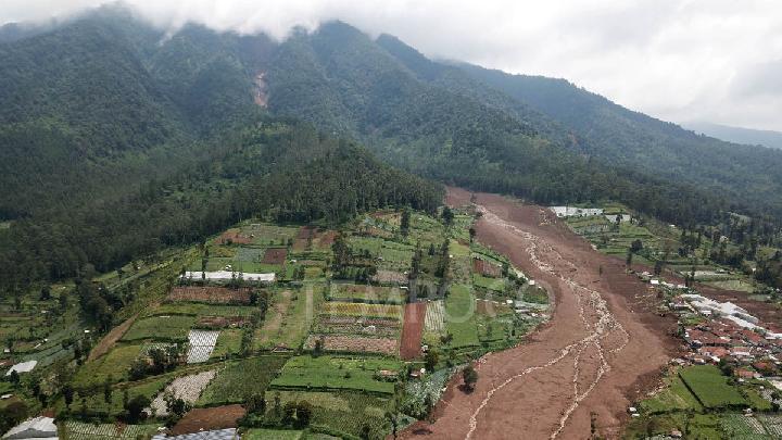
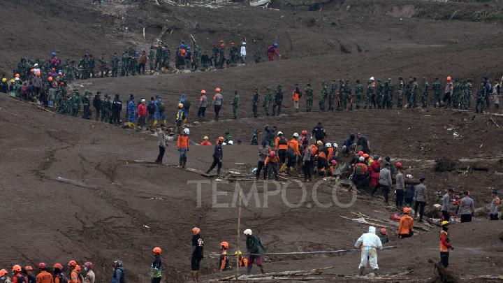
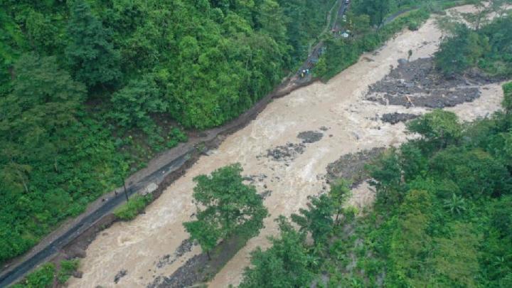
TEMPO.CO, Jakarta – The landslide-affected area in Pasirlangu Village, Cisarua District, West Bandung Regency, Indonesia, on Saturday, January 24, 2026, is categorized as a medium landslide vulnerability zone. Landslides can occur primarily on slopes that have been disturbed naturally or by human activity, particularly during heavy and prolonged rainfall.
"The characteristics of old, weathered volcanic rocks and the presence of geological structures increase the vulnerability of this area to landslides," said Acting Head of the Geological Agency, Lana Saria, in a written statement on Saturday, January 24, 2026.
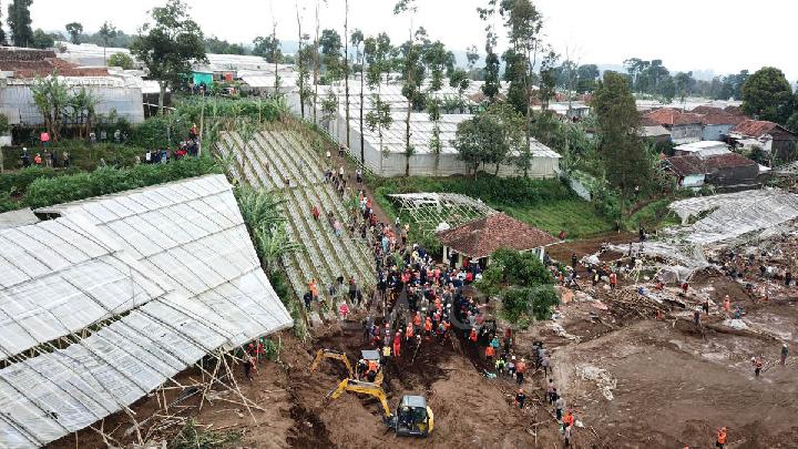
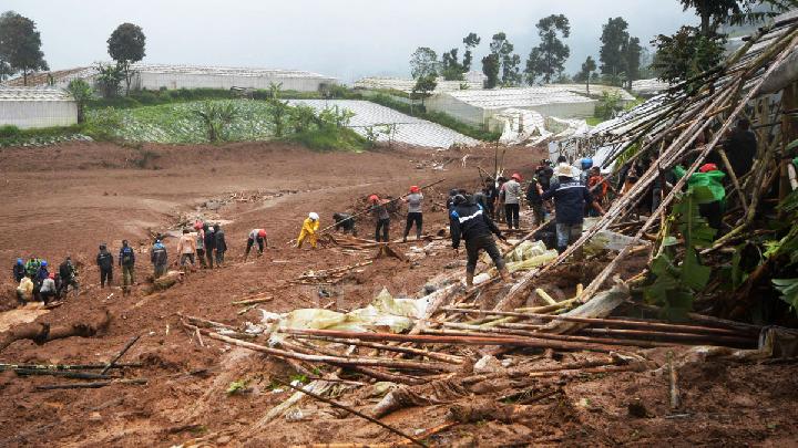
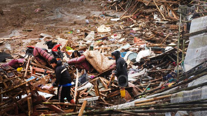
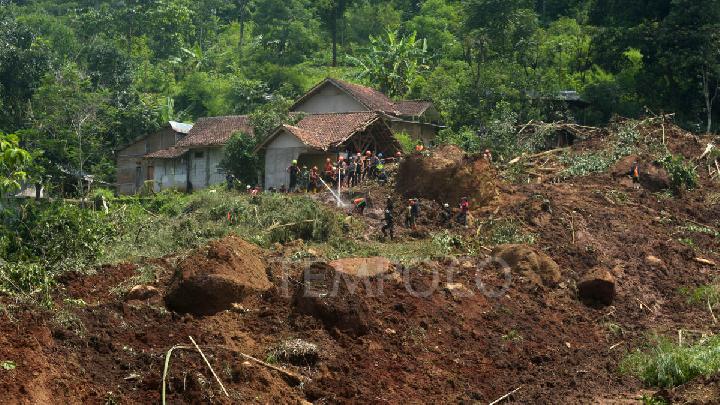
The landslide struck Pasirkuning Village in the early hours of the morning, affecting an estimated 30 hectares. Seventeen victims have been found, and 73 others are still missing.
The Pasirlangu Village area is a hilly area with dense settlements and fairly intensive land use activities. According to the Geological Agency report, land use around the incident site is dominated by residential areas, dryland agriculture, mixed gardens, and some open areas.
Slope cutting activities for settlements and road access, as well as inadequate surface drainage systems, have also affected slope stability and increased the potential for landslides. This incident, Lana said, "demonstrates a strong link between steep morphological conditions, weathered volcanic rock, geological structure, and the influence of high rainfall on large-scale landslides."
Meanwhile, the streams in the landslide area are small to medium-sized, following steep valleys and functioning as slope release zones. The local hydrogeology is characterized by a shallow groundwater system with a water table that easily rises during high rainfall. "Intensive rainwater infiltration into the soil layer resulting from the weathering of volcanic rock causes a significant increase in pore water pressure," Lana said.
Geology of West Bandung
West Bandung Regency is regionally influenced by a geological structural system of faults and fractures that predominantly trend northwest-southeast and southwest-northeast, related to the tectonic dynamics of the Bandung Basin and Quaternary volcanic activity. The presence of geological structures in the form of fracture zones and faults has implications for increased rock permeability and the development of weak areas that can act as slip surfaces for landslides. Locally, these structures accelerate weathering and water infiltration into the slopes.
Morphologically, the landslide-affected area is dominated by volcanic hilly landscapes of medium to high elevations. Slope gradients generally range from 8–40 degrees, with slopes classified as moderate to steep. In some sections of the slope, particularly around valleys and ridges, very steep slopes with gradients exceeding 40 degrees are found.
Geologically, the area of occurrence is composed of rock units comparable to the formations of ancient, indivisible volcanic deposits, as shown in the Bandung Regional Geological Map, West Java. These units generally consist of volcanic breccia, tuff, andesite-basalt lava, and highly weathered pyroclastic material. Advanced weathering conditions cause a decrease in the shear strength of soil and rock, increasing vulnerability to landslides, especially on moderate to steep slopes.
Cause and Chronology of the Landslide
The Geological Agency estimates that the landslide mechanism was initiated by rainwater infiltration into the weathered volcanic rock layer. This water accumulation increases pore water pressure and reduces the cohesion and friction angle of the slope material. When the driving force of the slope exceeds the resisting force, the soil and rock mass moves along the slip plane that develops in the weak zone, triggering a large-scale landslide.
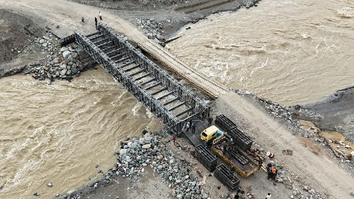
Residents near the disaster-affected area are advised to immediately evacuate to safer locations due to the potential for further landslides. The Geological Agency also urges residents, especially those near steep slopes, to remain vigilant, especially during and after prolonged heavy rainfall, as the area is still susceptible to further landslides.
Lana requested that landslide management and the search for missing victims be weather-conscious and avoid conducting activities during and after heavy rain, as these areas are still susceptible to further landslides that could affect personnel.
Read: Minister: Indonesian Gov't Continues Search for Victims in West Bandung Landslide
Click here to get the latest news updates from Tempo on Google News
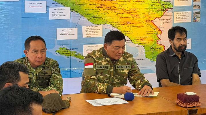
Minister: Indonesian Gov't Continues Search for Victims in West Bandung Landslide
4 jam lalu
The Indonesian government is prioritizing saving lives in handling the landslide disaster that struck Cisarua, West Bandung.
Walhi Blames Illegal Development for Deadly West Bandung Landslide
14 jam lalu
Walhi West Java suspects that extensive concrete development in West Bandung has damaged the environment and contributed to landslides.
How Did a Landslide in West Bandung Turn Into a Deadly Mudflow?
19 jam lalu
The head of the Disaster Research Center at the National Research and Innovation Agency (BRIN) explains the cause of the recent landslide in Cisarua, West Bandung Regency.
Facts About the Landslide Disaster in Cisarua, West Bandung
23 jam lalu
A landslide struck Babakan Cibudah Hamlet, Pasir Langu Village, Cisarua District, West Bandung Regency, West Java, early Saturday morning, Jan. 24.
Governor Dedi Mulyadi Relocates Residents After West Bandung Landslides
1 hari lalu
West Java Governor Dedi Mulyadi directly inspects the location of a landslide incident that claimed dozens of lives in Cisarua, West Bandung.
West Bandung Landslide: 8 Killed, 82 Missing
1 hari lalu
The National Disaster Management Agency reported a landslide in West Bandung Regency, West Java Province, on early Saturday, January 24, 2026.
At Least 4 Killed in Central Java Floods, Landslides
11 hari lalu
Floods, flash floods, and landslides have occurred in the surrounding areas of Mount Muria in Central Java since the end of last weekend.
Floods, Landslides Damage 225 Tourist Sites Across Aceh
12 hari lalu
The disaster on Indonesia's Sumatra Island in late November 2025 devastated many places in Aceh, including tourist areas.
Nearly 200 Sites Prepared to Relocate Sumatra Residents Displaced by Floods
13 hari lalu
The Indonesian government is speeding up the permanent housing construction for Sumatra residents displaced by floods and landslides.
Flash Floods Hit Tourism Village in Central Java's Jepara Regency
15 hari lalu
Floods and landslides have struck Tempur Village in Central Java's Jepara Regency on late Friday, January 9, 2026. Residents have evacuated.


:strip_icc():format(jpeg)/kly-media-production/medias/4174191/original/099991100_1664358430-bacaan-doa-setelah-adzan-beserta-arti-dan-keutamaannya.jpg)
:strip_icc():format(jpeg)/kly-media-production/medias/5385863/original/035777200_1760946460-KIP_Kuliah.jpg)
:strip_icc():format(jpeg)/kly-media-production/medias/5502852/original/043074800_1771048777-4.jpg)