
December 13, 2025 | 02:19 pm
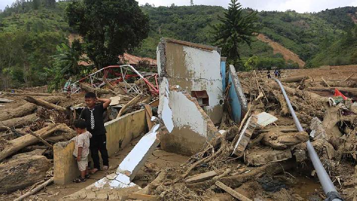
TEMPO.CO, Jakarta - Whatever people called them—rotting wood, fallen trees, or logs left from clearing sites—it made no difference to Andre Bustamar. For the Research Manager at the West Sumatra chapter of the Indonesian Forum for the Environment (Walhi), they are all tree stumps. What matters more, he said, was the alarming sight of thousands of those stumps swept away by the galodo, or flash floods, that tore through West Sumatra on Tuesday, November 25, 2025. For him, they were unmistakable signs of deforestation in the upstream sections of river basins.
Andre was not making baseless accusations. He pointed to spatial analysis based on Maxar satellite imagery conducted by West Sumatra Walhi on the Aia Dingin river basin in Lubuk Minturun village, Koto Tangah subdistrict, Padang. The satellite images, captured between June 2021 and July 2025, show clear changes in forest cover, revealing traces of systematic logging in the upper reaches of the Aia Dingin river basin.
When those satellite images were layered over the official forest-area map of West Sumatra, Andre said, the results strengthened indications of logging inside protected zones. Several of the identified clearing sites were located within conservation areas and protected forests along the Bukit Barisan mountain range. “Other sites are in areas designated for non-forest use but directly border conservation zones, serving as entry points,” he said at a Walhi National event in Jakarta on Monday, December 1, 2025.
West Sumatra Walhi’s assessment found dozens of land-clearing and logging sites precisely on the upper ridge of the Aia Dingin river basin. The pattern was clear, the activity started from the upstream and moving downstream toward the coast at Air Tawar Barat, one of the places where piles of logs washed ashore after the floods. Logs of various sizes were also seen floating on Lake Singkarak.
Prabowo Claims Situation Improving in North Sumatra Following Disaster
1 jam lalu
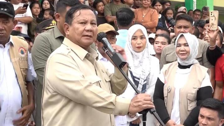
Prabowo said conditions in North Sumatra have improved since late-November floods and landslides, with the government monitoring affected communities.
Prabowo Says Gov't Is Planning Replacement Housing for Sumatra Flood Victims
4 jam lalu
"Plans are already in place to replace all the damaged homes," Prabowo said.
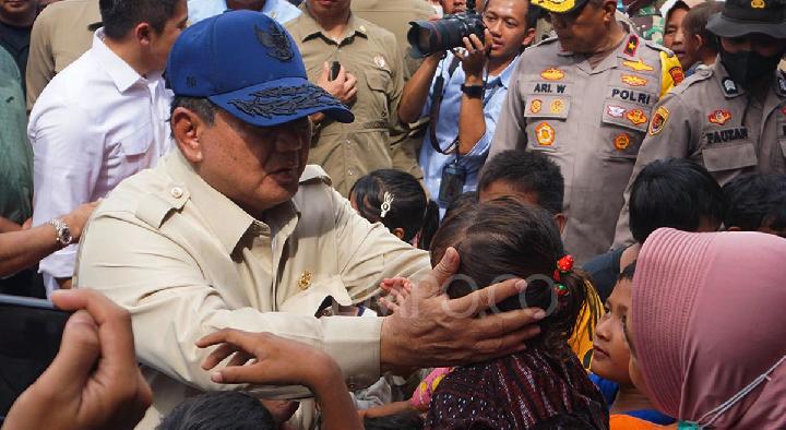
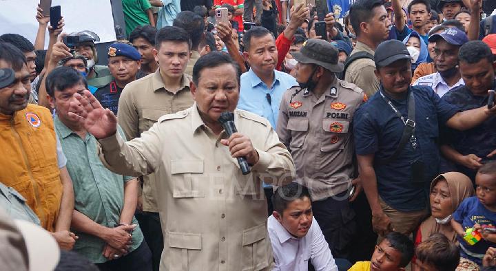
Prabowo Offers Apology, Calls for Patience on Visit to Disaster-Stricken Aceh
6 jam lalu
President Prabowo Subianto visited three districts in the province of Aceh affected by floods and landslides.
Prabowo Apologizes for Slow Power Grid Recovery in Sumatra Flood Zones
15 jam lalu
President Prabowo apologized to flood victims in Sumatra for the power outage during his visit to a shelter in Aceh.
Five Regions in South Sumatra Placed on Flood and Landslide Alert
16 jam lalu

The Regional Disaster Management Agency (BPBD) of South Sumatra has declared a flood and landslide alert in five regencies/cities.
Pelni Waives Rp1.4 Billion in Shipping Costs for Aid to Sumatra
16 jam lalu
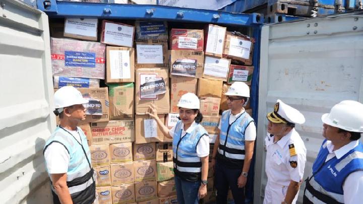
PT Pelni waives the shipping costs of 47 TEU containers filled with logistics aid sent to various regions in Sumatra.
US: Thousands Told to Evacuate Amid Floods in Washington
21 jam lalu

The torrential rainfall in the Pacific Northwest is due to a weather phenomenon called an atmospheric river.
Walhi West Sumatra: Floods Are an Ecological Crisis, Not a Mere Natural Disaster
22 jam lalu
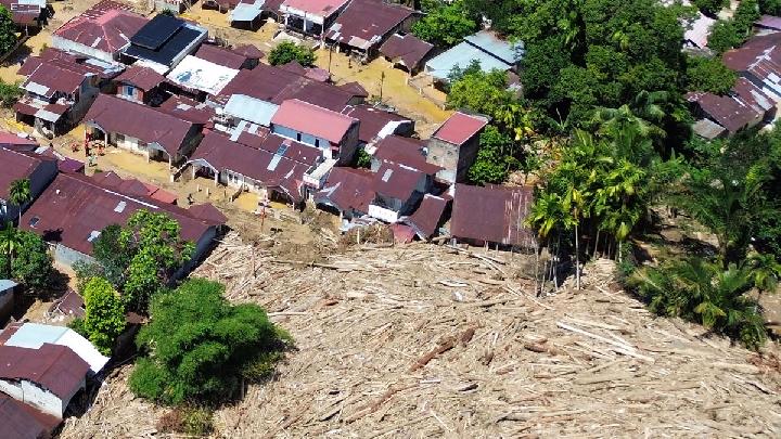
Walhi notes that around 158,000 hectares of forest in West Sumatra have been converted into oil palm plantations between 1990 and 2014.
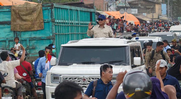
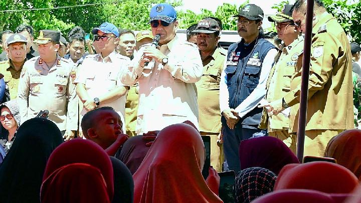
Prabowo Urges Flood Victims in Sumatra to Remain Patient
22 jam lalu
President Prabowo promises to build permanent housing for flood victims in Sumatra.
Timor Leste's Xanana Gusmao Offers "Heartfelt Condolences" over Sumatra Floods
1 hari lalu

Timor Leste Prime Minister Xanana Gusmao expressed condolences for the Sumatra flood in his speech.


:strip_icc():format(jpeg)/kly-media-production/medias/4010689/original/086569000_1651202668-pexels-rayn-l-3163677.jpg)
:strip_icc():format(jpeg)/kly-media-production/medias/5428698/original/015580400_1764559226-Kalender_HIjriah_Desember_2025.JPG)


:strip_icc():format(jpeg)/kly-media-production/medias/2855596/original/055794600_1563344847-iStock-1134972492.jpg)
:strip_icc():format(jpeg)/kly-media-production/medias/5424037/original/048660500_1764130779-sholawat_ujang_bustomi.png)
:strip_icc():format(jpeg)/kly-media-production/medias/1626268/original/067647800_1497616352-Mantan-MenKes-Siti-Fadilah-Divonis-4-Tahun-Penjara-01.jpg)
:strip_icc():format(jpeg)/kly-media-production/medias/4990655/original/018003600_1730716747-tata-cara-sholat-tahajud-agar-keinginan-terkabul.jpg)